
This map layer provides information on which countries have experienced environmental conflicts to date.
In the last few decades, the topic of environmental security has been steadily brought to the public eye and, at the latest since the start of the newly inflamed debate on the links between climate change and conflicts, it is back on the global political agenda. Research groups from the United States and Europe investigated numerous conflicts in terms of environmental degradation as a cause of conflict. The data in the map originate for the most part from a study which was produced in the context of the WBGU (German Council on Global Change) flagship report “World in Transition: Climate Change as a Security Risk”. In total 73 conflicts were analyzed for this and classified by type regarding the cause of conflict and intensity. Even though no predominant type of environmental conflict stood out globally-speaking, they were able to nonetheless observe the following four regional types of environmental conflicts: Land use and soil degradation conflicts in Central America, soil degradation conflicts in South America in which the loss of biodiversity plays an important role, water and soil degradation conflicts in the Sahel belt, as well as water conflicts in the Middle East. Additionally, data from the online portal ECC’s (Environment, Conflict and Cooperation) Factbook were also consulted. This Factbook analyzed the complex relationships between climate change, environmental changes and state fragility for more than 100 conflicts. In relation to the conflicts presented, it should be noted first that environmental degradation and environmental stress, respectively, are merely individual factors in a complex network of causes. Consequently, the socio-economic and political contexts must always be taken into consideration. Second, the intensity of conflicts varies.
© picture-alliance / dpa
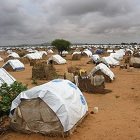
Environmental refugees
It is more than likely that climate change will lead to such profound and widespread environmental changes that in many places people will have to leave their homes. In a UN Environment Programme Paper, author Essam El-Hinnawi had already warned of this migratory outflow in 1985.
More ...")
")
")